Aerial Photogrammetry
Matrix-Geo provides photogrammetric mapping services by using Aerial Images captured from Manned Aircraft or Helicopters
We Develop Most Accurate Dataset From Aerial Surveys
Aerial Photography
Matrix-Geo provides Aerial photography services of all scales using different cameras like Ultracam-X, DMC, RC-30, RMKTop etc, through our associate flying partners.
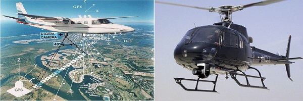
Digital Aero Triangulation
Aerial Triangulation is the process of densifying and extending ground control through computational means. In simple language the collective orientation of more than two photos is called Aerial Triangulation.
- To minimize the cost of surveying.
- To control the area with minimum no of GCP.
- To solve the problem of datum difference in between model and strip lap.
Matrix-Geo Solution has carried out many types of Digital Aerial Triangulation. We have industry’s best skilled recourses that are well educated, trained and experienced in the latest AT technologies. We use high end software’s for AT like Socet Set with Bingo, LPS- from Leica and Match-AT from INPHO
 We have expertise in handling complicated situations:
- Coastal Areas with cross line photography
- Water covered areas, like Small Island
- Dense forested areas
- Contrast free areas like sand dunes etc.
- Bad photography with bad geometry and radiometry deficiency
- Bad photography with lots of crab angle (Kappa value)
- Can handle almost all sensors and cameras i.e. any analog and digital camera like RC30, RMK Top, Ultracam-D, and Ultracam- X, DMC, and Medium format digital camera, small format Amateur digital Camera, with or without IMU data.
3D Planimetric/Topographic Mapping
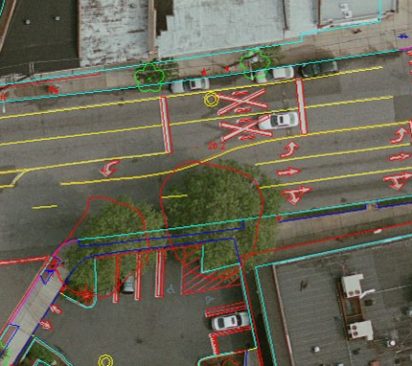
3D Planimetric/Topographic mapping mainly represents the earth surface features in 3D manner using Line, Point/Symbol and Polygon/region data. With this 3D Vector data user can make different analysis and decisions based on their specific need and applications.
Matrix Geo uses industry-high end software like Socetset, VR Systems, INPHO coupled with technical expertise to provide high-quality production of 3D vector data.
We work 24×7 in three shifts. So our technical staff is always available for our worldwide clients. We also use PMX, our internally built software application for all production processes. PMX provides clients secure 24/7 online visibility into job status and communication.
Matrix Geo has experience of executing more than 1500 large to small mapping projects for various industry sectors and applications. Our clients are from different continent of the world and agencies.
We generally provide solutions to the following sectors
ENGINEERING APPLICATIONS:
- National mapping
- Civil Survey Planning & Design
- Plant/Facility Planning & Management
- Roadway Design
- Storm Water Management
- Utility Management
- Topographic Surveys
- As-Built Surveys
- Mine Mapping and Management

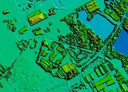
DTM/DEM Extraction
Digital Terrain Modeling (DTM) is the collection of mass points of elevations and 3D break lines at each change of terrain using softcopy workstations.
We generate high quality DTM/DEM for topographical mapping as well as for DTM for Orthophoto generation too.
Matrix Geo provide high-quality Digital Elevation Models. We place great emphasis on accurate terrain representation by collecting additional spot elevations and break lines thereby ensuring the highest quality deliverables.
We provide following services for elevation models
- High quality DTM/DEM/DSM/DHM
- Elevation data in different formats – ESRI Grid, Erdas Img, any other rater or vector format
- Topographic Contours
- Elevation data quality statistics
- Slope analysis
- Flood and Volumetric analysis
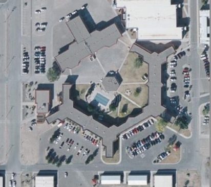
Digital Ortho Photography
Digital Orthophoto is a raster image generated by differentially rectifying aerial photographs or satellite images to compensate for distortions due to the altitude of the aircraft and the relief of the terrain. Digital Ortho photos combine the image characteristics of a photograph with geometric qualities of a map
Matrix-Geo has carried out several large ortho rectification projects world wide. We have industries best skill resources and the high end Software like OrthoBox from INPHO
We have expertise in following types of ortho rectification.
- Conventional Ortho
- True Ortho
- CIR Ortho
- RGB Ortho
- Satellite image rectification
We are capable of handling large numbers of images in one go i.e. 2000 to 5000 images from low resolution to high resolution.
3D City Modelling
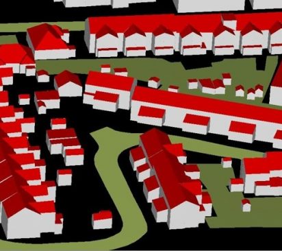
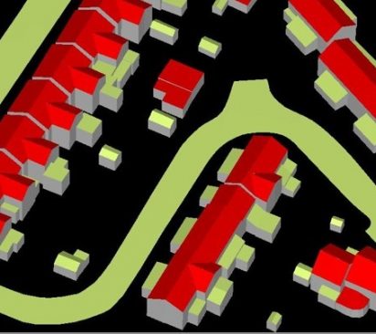
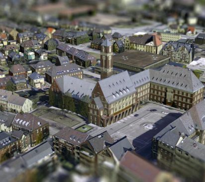
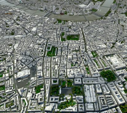
Using 3D Modeling and virtual reality techniques, we are able to completely represent the real world, bringing together all the relevant aspects of the 3D environment that you wish to model.
Matrix-Geo offers complete 3D modeling services, including detailed texturing, city modeling, 3D visualization, 3D environment modeling, true 3D landscape reconstruction, visual reality and virtual reality integration, real time roaming with huge amounts of data and enabling final product delivery through web based platforms including Microsoft Virtual Earth and Google Earth. Matrix-Geo supports most industry standard formats and outputs. Our experience includes:
- Auto-textured 3d building models – V3D files and texture folders
- Raw terrestrial Images
- Maps and image snaps
- Adobe format outputs
- Image Align PRO
- Digicad 3D
Matrix-Geo use very high end 3D city modeling software like Cyber city, which do most of the job automatically with very high efficiency and quality. These 3D modeling techniques are widely used in:
- City development planning
- Civil engineering planning and design
- Municipal management on various levels
- Intelligent transportation management system
- Real estate development and management
- Comprehensive management of district and residential areas
- Environment protection systems
- Land use management
- Natural resource exploration and management
